Segno - Kino Birthplace
Comune di Predaia, Italy
CORRESPONDING SUBJECT PAGE LINK: Click on the link below to the corresponding subject page that presents Kino’s life in Europe and his travels to Spain. To view the corresponding page, click Europe's Son page.
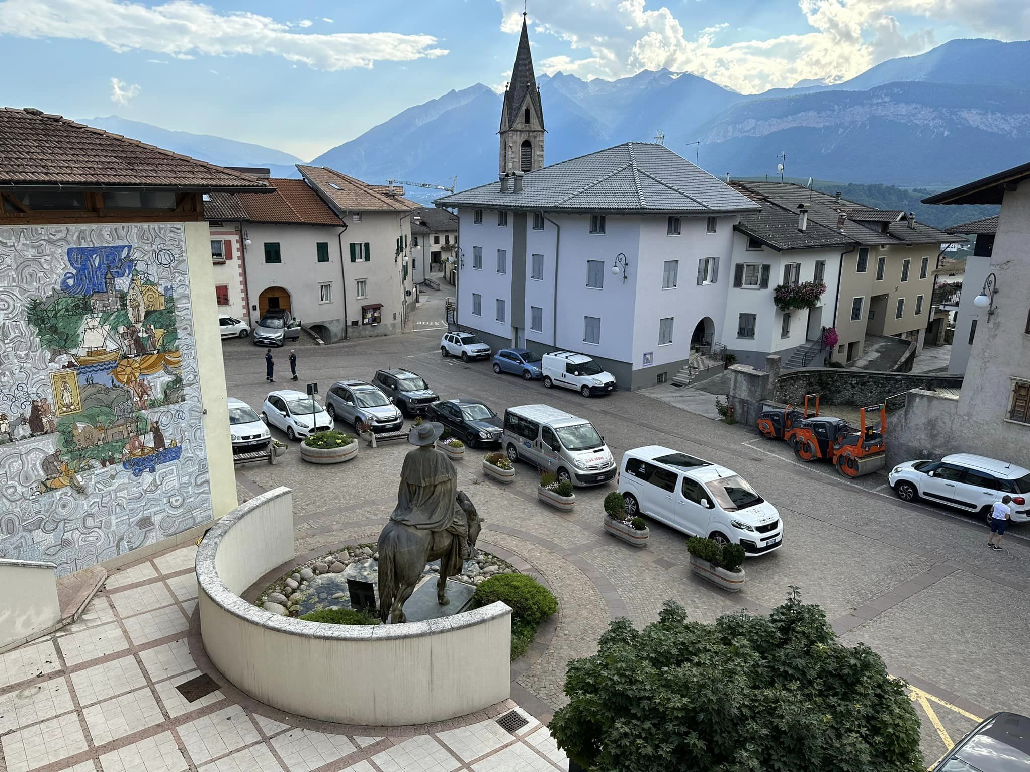
Segno View of Kino Piazza and UNESCO Recognized Brenta Alps
Father Kino's Birthplace - Segno, Italy
Herbert E. Bolton
A few miles northwest of the famed Italian City of Trent, in the Tyrolese Alps, lies the miniature basin known as Val di Non. It was the Anaunia of Roman days. This picturesque intermountain vale, hemmed in on the west by a sierra that seems to touch the sky and on the east by a less ambitious range, is a veritable amphitheater, as a classic writer once called it. At its southern end the valley is entered by a road which winds through a narrow gap by which the river Noce finds its tortuous exit from Val di Non to join the fuller flooded Adige. The floor of the valley and the enclosing slopes are dotted with little villages, some of which pride themselves on an antiquity that carries them back to pre-Roman days. Cles, the principal town, is distinguished among its almost jealous neighbors for the discovery there in 1869 of the now celebrated Tavola Clesiana, the beautiful bronze tablet on which is inscribed the edict of Emperor Claudius granting Roman citizenship to the inhabitants of Val di Non in the year 46 of the Christian era.
Proudest of all these old towns is Segno, a snug little hamlet which nestles in a fold of the hillside on the eastern border of the valley midway of its length. And Segno's boast is not of her antiquity nor of her archaeological treasures, but of the simple fact that within her precincts was born Eusebio Kino, the renowned Jesuit missionary explorer of the Pacific Coast of North America.
Herbert E. Bolton
Val di Non
Rim of Christendom: A Biography of Father Eusebio Francisco Kino: Pacific Coast Pioneer
Padre Kino Cultural Center and Museum
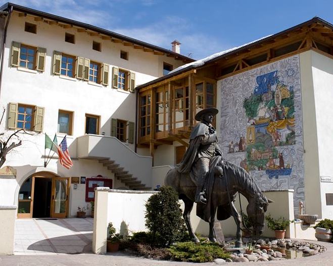
Benevenuti!
Village of Segno, Comune di Predaia, Province of Trent
The Padre Kino Centro Culturale (Padre Kino Cultural Center and Museum) features permanent exhibits about the famed pioneer Jesuit missionary and explorer Eusebio Francisco Kino (1645-1711). Father Kino worked in today's borderlands of Northwestern Mexico and Southwestern United States and on the shores of the Gulf of California. Exhibits about Father Kino's life include presentations with artifacts of the indigenous people that Father Kino worked with.
The Culture Center sponsors talks and events about the history and culture of the New World (today's North & South America) and Europe's Alpine regions and hosts traveling exhibits. Many of the exhibits feature subjects about the indigenous people of North America, past and present..
The Cultural Center on two floors is located on the main square of the village of Segno, Father Kino's birthplace. The Cultural Center is easily reached by automobile, train or bus from Trent, Italy that is 32 kilometers (20 miles) to the south.The village of Segno is located in the Val di Non and in the Comune di Predaia - Segno's muncipal government district for the Province of Trent.
The Associazione Culturale Padre F. Chini (Padre Eusebio F. Chini Cultural Association) operates the Culture Center. Chini is Father Kino's family name. Kino is the Spanish version of Chini.
During the summer months of June, July, August and September, the museum's hours are from 14:00 pm to 18:00 on Tuesday, Wednedsay, Thursday, Friday and Saturday; from 15:00 to 18:00 on Sunday. On Monday, the Cultural Center is closed. No appointment is necessary - just walk in and see the museum
During other times of the year such as during the fall, winter and spring seasons, the Culltural Center may be visited in the morning hours if an appointment is made in advance.The Cultural Center requests that it be contacted by email or telephone.one week before a planned visit to the Cultural Center during the fall, winter and spring seasons.
Email: info@padrekino.org.
Telephone is: 39 046 346 8248.
For more information about the The Associazione Culturale Padre F. Chin and Cultural Center
Click
http://www.padrekino.org
The Associazione website is presented in Italian, German, Spanish and English.
To access information about the Cultural Center in English on the official TrentinoTourist website
Click
Kino Center - English
The Cultural Center and the Padre Chini Piazza for outside events is accessible by people with disabilties.
For more information about the Cultural Center in Italian with access information,
Click
Kino Center - Italian
The Associazione Culturale Padre F. Chini invites you to visit the Cultural Center and wishes you a wonderful stay in the Province of Trent.
Val di Non - Valley of the Non People
Birthplace of Padre Kino
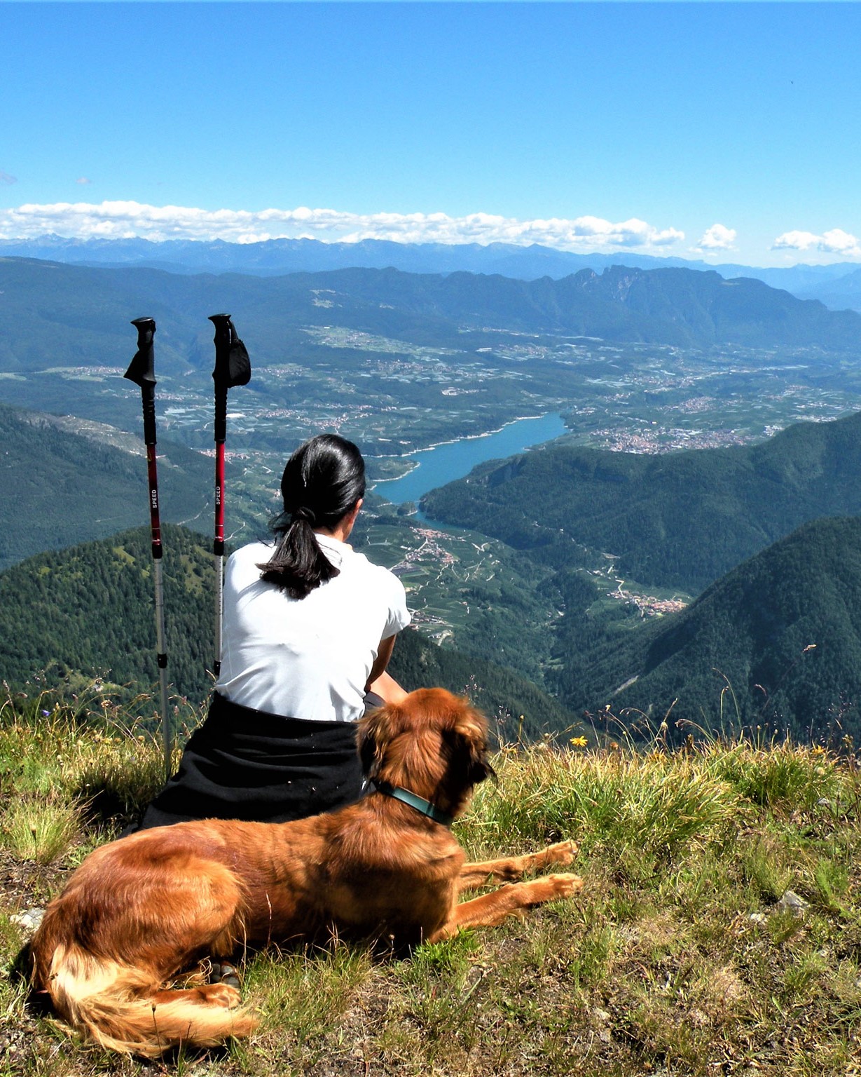
The Val di Non Viewed From The North
Lago di Santa Giustina in photo center
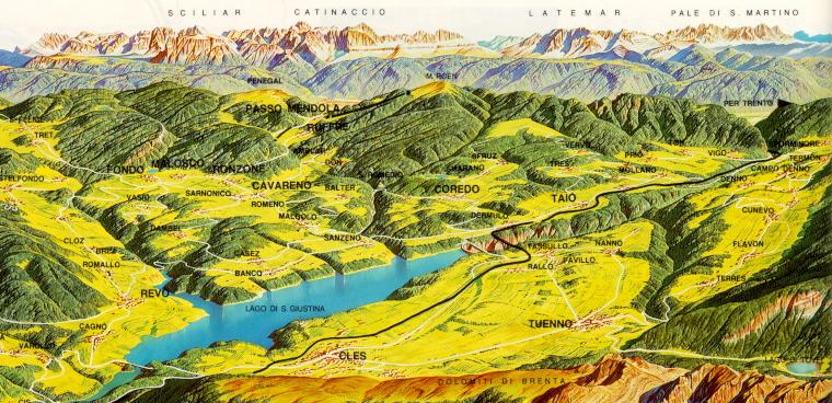
Map of the Val di Non
Segno is located south (right) of Taio and north (left) of Mollaro in center right of map
The top of the map is a view east towards Adige River and the Northern Dolomite Alps
Val di Non Web Page
Click
www.visitvaldinon.it
Val di Non on Facebook
Click
https://www.facebook.com/ILoveValdiNon/
The Val di Non (Non Valley) although referred to as a valley is geologically a mountain plateau. Shaped like a wide amphitheater, the Val di Non covers over 300 sq. miles (600 sq. km.)
The Val di Non (Valley of the Non People) is also known as "The Valley of Canyons" The Noce (Walnut) river with its deep gorges divides the valley lengthwise, and its perpendicular tributaries divides the valley along its width. The river tributaries with their deep slot canyons on the east side are: Rinassico, Ponagaiola, San Romedio, Novella, Pescara and Barnes; those on the west side are: Sporeggio, Lovernatico and Tresenga.
In the center of the valley is Santa Guistina Lake (Lago di Santa Giustina) The lake holds 170 million cubic meters of water with a surface area of 4 sq. km. The Santa Guistina dam was built between 1943 and 1950 and is 152.5 meter high
The valley is surrounded by mountains with peaks from 2000 to 3000 meters. The Anaunian Alps is on the the valley's eastern side. The UNESCO recognized Parco Naturale Adamello Brenta is on the west. The Maddalene mountain chains is on the north and the Andalo saddle is on the south.
The valley is characterized in its lower to middle elevations by extensive apple orchards. As you move in up elevation there are meadows with extensive forests of pines and fir-trees. At the highest elevations are forests where larch and birch predominate. Large fauna consists of deer, chamoises, marmots, royal eagles and bears. In the rivers and streams trout abound. The richness and diversity in the flora and fauna are protected by the Adamello-Brenta Natural Park. The park's Lake Tovel is very famous in the past because in the summer it became red due to a micro-organism called Glenodineum Sanguineum Marchesoni
The Val di Non has about 36,000 inhabitants. There are 38 municipalities (communes) with 3 to 6 villages per municipality. Cles is the largest town in the Val di Non with 6,000 inhabitants and is also the biggest commercial center. In some municipalities the first language spoken is German. Segno in the municipality of Predaia named after the large plateau. Other communities in the municipality of Predaia are Coredo, Dardine, Dermulo, Mollaro, Priò, Smarano, Taio, Tavon, Torra, Tres, Tuenetto, Vervò, Vion
The Valley di Non has many attractions: Winter skiing and sports. In the summer hiking, mountain biking and rock climbing. The many culture attractions including the Santuario di San Romedio and the Castel Thun that are within a few kilometers of Segno.
The Val di Non is known for it unforgettable landscape, untouched nature, and its arts, culture and outdoor sports.
Description adapted from Predaia Orienteering Club web page.
For its webpage
Click
http://www.oripredaia.it/english/the-val-di-non.html
Province of Trent - Heart of Europe
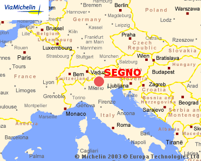
Segno is located In the The Heart of Europe - The Italian Province of Trent
Trentino Captivates You
Tourist Guide
Trentino is the traditonal name for today's Autonomous Province of Trent with its major city of Trent. The tourist guide lets you know Trentino's regions with Alpine mountains, lakes and its unique valley communities. The guide suggests sites to see with route itineraries and annual events. Also local foods are featured. The maps are excellent.
The guide to the Val di Non begins on page 26.
To view and download, click →
http://www.italiantouristoffice.se/sv/docs/341.pdf
To view and download "The Valleys of Tirol: Their Traditions and Customs and How to Visit Them" (1874) click→
http://www.gutenberg.org/files/43614/43614-h/43614-h.htm

Segno is Less Than 30 Minutes From the Beautiful City of Trento (Trent)
by Automobile, Bus and Train
For information about traveling to Segno by train and bus
Click
http://www.padrekino.org/en/raggiungere-segno/
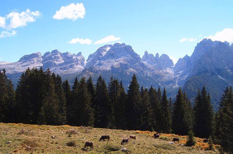
Brenta Alps From The Valley Floor of the Val di Non
Web Camera Located First Ridge Saddle Left of Center of Photograph
Web Camera View of the Val di Non and Segno
Click →
https://madonna.panomax.com/groste#
Instructions
Viewing and Pointing The Camera Toward Segno - Between North-Northeast and North-East Directions
Web camera automatically rotates 360 degrees counterclockwise unless stopped. When web camera site opens, its its view is due south - opposite the general direction of the Val di Non which is right of due north or top of the page
To align the field of view towards the Val di Non, click on lower left most tab named "Overview Map". A Google map will pop up and fill the one-quarter of the screen on the left side. Drag or spin with your cursor the dark green cone in the Google Map and move the cone's open end toward the center between North-Northeast and Northeast directions (direction indicators sometimes appear at top of picture - the indicators do not appear in the map window). This position is.left of the up postion. The cone's open side should be pointing towards the town of Taio where the cone should be centered. Segno is less than a mile south of Taio. See below next picture for instructions location and how to zoom in on Segno.It may be helpful to have the mountain cliffs (Cima Groeste) on the left that has a vertical metal pipe or cable in the foreground in the view and then later zoom in into the valley.. ,.
At dawn Lake Santa Giustina can be seen with a few villages in the notch the is formed by the lowest ridge lines in the center. Zoom in the area to see the lake. Segno is located just right or south 3 miles from the dam of Lake Santa Giustina. The dam is at the right side of the lake and is at the bottom lower part of the image. .
Sometime you can see the direction indicators at the top of the picture and Segno is in the middle between North-Northeast and Northeast directions. Also look also in the above picture to see alignment of compass in upper right corner.
Segno is located a few hundred feet south of Taio on the Google Map. The direct line of sight between the web cam and Segno is approximately 8 miles. By automobile the drive is about 30 miles to the Ursus Groste Skipark.
The web camera is locate in the Ursus (Bear) Groste Skipark in the Brenta Dolomite Alps which are recognized by UNESCO as a world natural heritage site.The Ursus Groste Skipark is part of the Skiarea Campiglio Dolomiti di Brenta. The 360 views are spectacular. The site has many features including yearly seasonal timeline photographs,. time lapse sequences and current weather conditions.
The time lapse tab is very useful except that I have not learned to zoom in.on an image like can be done with real time images (really minus 20 minutes) Again it is important to set the field of view with the "Overview Map" tab toward Taio and Segno during the time sequence otherwise the camera will rotate in a circle. To stop the time lapse sequence, slide the Speed Button to the center between the red and green lines. Again it may be helpful to have the mountain cliff on the left that has a vertical metal pipe or cable in the foreground to make sure the valley is in the view. I have been able to move the field of view vertically in a 360 degree circle. I have not been able to zoom in.during the time lapse sequence or on a single image.
Kino Cultural Center Lecture Series

"Following Father Chini's Footsteps in 17th Century Pimería Alta"
Dr. Deni Seymour - Leading U.S. Southwest Ethnohistorian & Kino Archeologist
May 8, 2018

"Kino In The Context Of The Participation Of Italian Jesuit Missionaries In New Spain"
Dr. Gilberto López Castillo - Historian and Anthropologist - INAH Mexico
November 6, 2019

Author Presentation of The Monumental Book
"Kino en California Textos, Cartografías y Testimonios 1683-171"
Author Carlos Lazcano Sahagún
Director of the Museo de Historia de Ensenada, Ensenada, Baja California, Mexico
August 10, 2024